Showing posts with label BMP Q and A. Show all posts

Friday, April 17, 2015

Spring 2015 BMP Q&A

By: Todd Thomas, Water Resources Forester, Texas A&M Forest Service

Q: I have an old road that I use to access most of my property that is fairly steep in some parts and has high banks on either side.  The road itself has a good crown on it and sheds water well.  The problem lies with the ditches.  Due to the high banks I am unable to install any turnouts to give the side ditches some relief until the road reaches the bottom of the hill.  This makes for severely gutted out ditches.  What can I do to keep my ditches from being so washed out? 

A: Excellent question. Believe it or not, you are not alone in your problem.  This is especially common on roads that are retired county roads where years of grading left the road severely below grade.  Your issue is extremely problematic because if left untreated the erosion occurring in your ditches will eventually begin to undercut your road. 

The best option that comes to mind that would be the most long-lived would be the installation of small “Reno mattresses” in your ditches.  A Reno mattress is comprised of chicken wire, stakes (ideally rebar), wire ties and rock or other aggregate.  These installations should take up the full width of your ditch, be approximately one to two feet wide, and one to two feet tall.  The rock or rip rap you use should be bigger around than that holes in the chicken wire. 

Small Reno mattress installations in side ditch on steep grade
To install a Reno mattress, lay the chicken wire the width of your ditch, dump your aggregate on top of the wire to form a mound one to two feet wide and one to two feet tall, fold the wire over the top of your rock mound and use wire to tie the chicken wire shut.  Next, take your stakes and stake the Reno mattress down on the front and on the back.  When installing the Reno mattresses take care to ensure that any flow will not wash out the edges or undercut the installment.  To determine the number and spacing you will need, consult the Texas Forestry Best Management Practices Blue Book.  The chart for waterbar spacing on page 54 should suffice, however if you think you need more, go for it.  More of these will certainly not be detrimental.   

Top view of  Reno mattress
The functionality of these Reno mattresses is twofold.  The first function, as with all BMPs is to slow down the flow.  The second function occurs from the slowed down flow; once the flow in the ditch is slowed down any sediment it is carrying with it should settle out behind the installment.  Over time this should work to fill in the ditch behind the mattress while allowing water to pass on through.  Sort of a “filtering” effect. 

In closing, remember the primary functionality goals of BMPs, slow down flow to reduce erosion and to allow any sediment travelling with the flow to settle out.  Be sure to keep the questions coming.  You can call our office in Lufkin at any time, the number 936-639-8180, or you can email me at tthomas@tfs.tamu.edu

Thursday, May 8, 2014

May 2014 BMP Q&A

By: Todd Thomas, Water Resources Forester, Texas A&M Forest Service


Q: As a result of some of these spring time rains we have been experiencing, several of the permanent roads we use have stayed wet and become a major headache.  For future reference, what do you recommend to help decrease the amount of time it takes to dry these roads out?

A: After some of the dry weather we’ve had the last couple of years, there’s no doubt that the rain is welcome, but with it comes issues like the one you’ve brought up.  As they say, “the wetter the road, the weaker the road.”  One method that comes to mind for decreasing the amount of time it takes for a road to dry out is called “daylighting.”

Sun and wind are the primary agents needed to dry out a road.  Daylighting is a method that that entails clearing trees along the edge of the road in order to increase air circulation and allow more sunlight to hit the road surface.  The forest canopy intercepts quite a bit of wind and sunlight.  The more sun and wind that reach the road, the faster it will dry out, allowing you to work more efficiently, reducing erosion potential, and increasing the life span of your road.  How far you decide to remove these trees on the sides is up to your discretion, really just enough to get that sunlight and wind onto the road surface.  
 
This road is receiving optimum sunlight and air circulation now,
but later on these trees along the side may need to be removed.

Due to our location on the Earth’s surface, the southern side of east-west running roads should receive the most attention in order to maximize the amount of afternoon sun that hits the road.  Generally speaking, afternoon sun has a greater intensity than morning sun and a southern exposure will receive more direct sunlight than a northern exposure.  On a north-south running road, the west side should have more trees removed than the east side, to maximize the afternoon sun.  In areas with substantial curves in the road, go ahead and take several trees out of the inside of the curve to enhance the daylighting process and to increase visibility down the road as a safety precaution. 

In addition to allowing the road to dry faster, daylighting also helps to increase vegetative cover.  Increased grasses on the road surface when the road is not under heavy traffic loads will do two things.  The root structure of the grasses will do an excellent job of holding soil in place while the grasses themselves intercept rainfall and reduce soil particle displacement from raindrop impact.  The second benefit to the road is that the grasses will also aid in removing moisture.  As these grasses grow and conduct photosynthesis, they will remove moisture from the soil comprising the road bed and then transpire it into the atmosphere.  The increased number of grasses and forbs growing in the road and on the sides of the road will be of great benefit to wildlife as a food source.  So you are not only helping the road system but you are helping to feed our furry friends.  Who knows, maybe they’ll grow some bigger antlers and be more convenient to load into the back of the pickup since they are hanging out on the road! 


In conclusion, if your primary access roads are staying too wet, you may want to consider removing some trees along the side of the road in a process known as “daylighting.”  Remember, forest roads have the potential to severely degrade water quality and by keeping them in good shape, you are helping to keep our waters clean as well.  If you have any questions, feel free to call me at 936-639-8180, you can reach me by email at tthomas@tfs.tamu.edu, or just swing by our office in Lufkin. 

*This article was published in the May 2014 edition of the Texas Logger

Tuesday, March 25, 2014

March 2014 BMP Q&A

By: Todd Thomas, Water Resources Forester, Texas A&M Forest Service

Q: Recently I was considering various revegetation options so I decided to consult the trusty old blue book.  On page 68, in the chart that has different types of grasses and planting rates, etc., I noticed under plating rate that most everything is listed as lbs/acre.  However, there were some that instead of “lbs”, the unit was “bu”.  What does “bu” stand for? 

A: First and foremost, I commend you on exploring other revegetation options and taking advantage of our seeding chart.  To answer your question, “bu” stands for “bushels”.  Species listed in bushels per acre are to be sprigged instead of seeded.  Species that require sprigging are generally hybrids such as Coastal Bermuda grass.  Since they are hybrids, they do not reproduce from seeds, but from roots or runners. 

Bermuda Grass Sprig

Now you are probably asking yourself, “How much exactly is a bushel?”  Do not worry, you are not alone, this is not a common unit of measurement these days to say the least.  A bushel is defined as a volume measurement that contains 32 quarts, 8 gallons, or 1.25 cubic feet.  Length times width times depth in feet divided by 1.25 or multiplied times 0.8 will give the number of measured bushels a truck or trailer can hold.

Species of Bermudagrass are excellent options for erosion control.  These species are perennials, so under the right circumstances, they will return year in and year out, making them ideal for areas that will not be placed into timber production.  Bermuda also has an extensive root structure that does a superb job of holding the soil in place.  The fine blades of Bermudagrass above the soil surface were almost designed to intercept overland flow. 


I hope I was able to clear up some of the confusion out there concerning our revegetation chart.  If anyone out there has any BMP related questions, please do not hesitate to contact our office in Lufkin.  The phone number is 936-639-8180, you can also send them to me via email, my email address is tthomas@tfs.tamu.edu

*This article was published in the March 2014 edition of the Texas Logger

Monday, November 11, 2013

November 2013 BMP Q&A

       By: Todd Thomas, Water Resources Forester, Texas A&M Forest Service

Q:  While conducting a complete harvest on a site with dense underbrush, my crew accidentally cut through an area that should have been reserved as an SMZ.  Now that what’s done is done, what do you recommend as our next move?

A: While I hate to hear of the destruction of an SMZ, do not worry, not all is lost.  First things first, in order to eliminate any confusion during site prep and planting, the area that would have been SMZ needs to be flagged off.  This will avoid any intrusion of site prep or other management activities down the road that could cause any damage to water quality.
Aerial view of Streamside Management Zones (SMZs) on a recent harvest in East Texas

During site preparation and planting it is extremely important that any equipment on site stay out of the newly flagged off SMZ to avoid soil disturbance next to the stream.  This will reduce erosion and the resulting sediment that could enter the stream.  Remember, since you have harvested the timber off the tract, there will be more water wanting to enter the stream since those trees are no longer there to use it.  This means that there will be more water in the soil, especially right next to the stream, making the area much more prone to rutting.  If you do decide to plant this area when you are planting the rest of the tract, be sure and plant it by hand so you don’t rut up this sensitive area. 

Going ahead and marking off the area that would have been SMZ will also be extremely beneficial if you plan on using herbicides during site prep.  This will eliminate the possibility of any herbicide being directly applied to the stream.  Also, not spraying here will allow vegetation to re-establish itself quickly, and reduce erosion potential.  Not to mention this helps with maintaining biodiversity for wildlife habitat, one of the side benefits of SMZs. 

It may not be a bad idea to go ahead and plant a mix of hardwood seedlings in this area, just to ensure that things begin to reestablish at a rapid pace.  However, there is a good chance that there is enough seed already in the soil for seedlings and shrubs to grow in this area pretty densely.  I have heard stories relating to similar scenarios where hardwoods were planted, but were eventually out-competed by seedlings that grew from the already existing seed bank.  How you choose to approach this is totally up to your discretion. 

If you plant anything, it is probably a good idea to at least put down some grass seed.  There is chart that is extremely helpful in determining what to plant on page 67 and 68 of your blue book.  This form of revegetation will hold the soil in place while any seedlings are getting established.  Remember, per Texas BMPs, that it is not recommended to use fertilizer within an SMZ (page 66, blue book).  This is because excessive nutrients entering the stream can greatly degrade water quality. 

In conclusion, while it is never a good thing to slick off an SMZ, there are measures to restore the SMZ and to correct the mistake.  Remember to delineate the area, keep out equipment, and to actively manage the area to reestablish vegetation so that it can return to a functioning SMZ.  Keep the questions coming; you can call them in to me at 936-639-8180, or email me at tthomas@tfs.tamu.edu.

*This article was published in the November 2013 edition of the Texas Logger

Monday, September 9, 2013

September 2013 BMP Q&A

           By: Todd Thomas, Water Resources Forester, Texas A&M Forest Service


Q: My crew is in the middle of thinning a 15 year old pine plantation.  In the middle of the tract, leading down to an intermittent stream is an old legacy road that has washed out over time.  It is very apparent that the when all the timber was harvested over 15 years ago that no BMPs were used.  As this gully approaches the stream it gets deeper and deeper.  Where the gully meets the stream it is deep enough to swallow a pickup!  For the most part, the gully hasn’t eroded any more in quite some time.  There is little to no evidence of recent soil movement, and there is a pretty heavy layer of pine straw and other litter on top of the soil.  We have kept all our equipment out of the gully and haven’t cut any trees on the edge of the gully in order to keep things from washing out anymore than they already are.  What is our next move here?  How should we treat this highly eroded legacy road in future management operations? 

A: Excellent question, and one that addresses an issue that I am sure other folks are experiencing out there.  First and foremost, good job staying out of the gully and not harvesting the trees along the edge.  Even though the gully started out as a poorly placed road, it is now acting as an ephemeral drain and should be treated as such. 

The best way to keep this gully from eroding further is to keep equipment out entirely and to maintain a buffer of trees around the edge and above the head of the gully.  Now you may remember that Texas Forestry BMP guidelines do not require an SMZ on ephemeral drains, but depending on the situation, some protection is needed.  This is certainly a situation where some protection is needed.  The amount of protection, the width of the buffer, will depend on the soil type and topography of the site, based on your professional judgment. 

The buffer will accomplish several goals in the name of erosion prevention and protecting water quality.  The first goal is interception.  The canopy of the trees comprising the buffer will intercept rainfall and reduce the resulting soil movement from raindrop impact.  The second is root structure.  The roots of these trees will hold the soil in place, reducing the chance of the gully getting wider.  Since you are in the process of harvesting timber on site, the amount of water traveling to the gully is going to increase.  This surplus of water is a result of the harvested trees not being there to use it anymore.  The trees making up the buffer will intercept the bulk of this water, preventing further erosion. 

Maintaining a buffer also limits equipment intrusion.  Remember, since water is naturally draining towards the gully and in more abundance with less timber around to utilize it, the area around the gully is going to be much more prone to rutting.  Even in dry conditions it is important to minimize equipment operations immediately adjacent to the gully as this can cause soil disturbance that will eventually lead to further erosion issues. 

While it may seem like a good idea to place hay bales, slash, or silt fences in the gully, this should be avoided.  In a case such as this, where everything seems to have stabilized relatively well, putting something in the gully would likely cause further erosion on the side banks causing the gully to widen.  Placing hay bales or silt fences in the gully would not only enhance erosion, but also costs time and money.  Time and money that you could be devoting to other aspects of your operation, such as installing BMPs elsewhere!

In conclusion, an ephemeral drain is an ephemeral drain no matter how it started out.  No matter if a drain was put here by Mother Nature or the faults of man, at this point it deserves our protection.  Keep the questions coming, you can send them to me at tthomas@tfs.tamu.edu or call them in using the phone number 936-639-8180.  

*This article was published in the September 2013 edition of the Texas Logger

Tuesday, August 20, 2013

August 2013 BMP Q&A

                By: Todd Thomas, Water Resources Forester, Texas A&M Forest Service

Mmmmm....dips. But not quite.
Q: While looking through the blue book, I noticed that you have specifications for both broad-based dips and rolling dips.  I was always under the impression that these were basically the same thing.  Can you explain the difference between the two, and when you might use one instead of the other?

A: Excellent question, and one that we get quite a bit!  Upon first glance, rolling dips and broad-based dips do not appear to be much different at all.  They both accomplish the same goal: to provide cross drainage on in-sloped roads.  The differences between the two are quite subtle, but knowing these differences can save you time and money down the road when it comes to road construction and maintenance. 

Both rolling dips and broad-based dips are reverse slopes in the road surface that outslopes for natural cross-drainage.  Rolling dips are designed to be used on haul roads and heavily used skid trails.  Broad-based dips differ in that they are designed for use mostly on heavily used haul roads.  Rolling dips can be used on roads with up to a 15% grade, while broad-based dips should be used on roads that do not exceed a 12% grade.  The spacing on broad-based dips should change with every 2% change in gradient, while the spacing with rolling dips changes with every 5% change in gradient. 


With broad-based dips, the reverse grade should always be 3% and approximately 20 feet in length.  Rolling dips are slightly more flexible in their size and gradient.  Guidelines for rolling dips call for the reverse grade to be between 3% and 8% with the length ranging from 10 to 15 feet.  The slight differences between the two allow for higher vehicle speeds on broad-based dips than on rolling dips. 


Since broad-based dips are used on high traffic roads, some other considerations may be necessary.  On some soils, the dip and reverse grade section may require bedding with crushed stone to avoid rutting the road surface.  Also, energy absorbers such as rip rap, and in some cases, a level area should be installed at the outfall of the dip in order to slow down runoff and keep erosion minimized. 

With both types of dips, neither the dip nor the hump should have a sharp, angular break, but instead should be rounded to allow smooth flow of traffic.  Properly constructed dips require minimal maintenance and continue to function years after abandonment, saving your road and saving you money. 

Please keep your questions coming.  You can email them to me at tthomas@tfs.tamu.edu or phone them in by calling (936)639-8180. 

*This article was published in the August 2013 edition of the Texas Logger

Thursday, June 13, 2013

June 2013 BMP Q&A


By: Todd Thomas, Water Resources Forester, Texas A&M Forest Service

Q: When harvesting trees within an SMZ I've always been told to keep tops and slash out of the stream, however, when you walk along a stream in the forest there are tons of limbs already in the stream. What is the big deal?  I know it is a guideline, but why is it so important to keep limbs out of the stream when there are already so many there naturally?


A: You bring up a good point, but since there are in fact lots of limbs and debris in the stream bed, there is no need to add any additional debris.  First and foremost, the more debris that gets added to a stream the greater the likelihood of the stream being dammed up and as a result causing flooding.  Flooding is going to happen from time to time with heavy rains, but the less floods in these forested streams the better.  With excessive flooding comes the potential for more erosion on a site, as well as the potential for nutrient loss in the soil.  As the flood waters recede, the eroded soil and nutrients are then carried to the stream, severely affecting water quality.  This flooding could also cause a reduction in the amount of water downstream, further affecting other bodies of water.

Build up of slash in an intermittent stream in East Texas
With the increase of limbs in the stream also comes more scouring or erosion of the stream bank itself.  Since this already occurs naturally, additional scouring can be problematic.  The first issue comes with more sediment in the stream.  More sediment traveling downstream has many negative effects on water quality as well as on aquatic plants and animals.   This increased scouring also releases nutrients that were once stored up in the soil of the stream banks.  As more nutrients travel downstream, they can accumulate and degrade water quality. 

Another benefit of keeping the slash out of the stream is being able to utilize the slash elsewhere on the tract.  Slash is an excellent tool for erosion prevention on closed out skid trails and temporary roads.  Why contribute to a problem when something can contribute to a solution? 

In conclusion, keep slash out of streams, the folks downstream will thank you, aquatic life will thank you, and the landowner will thank you.  Remember extra debris in the stream contributes to flooding and water quality degradation.  Remember to keep the questions coming, you can send them to me at tthomas@tfs.tamu.edu or just phone it in by calling (936) 639-8180.  

*This article was published in the June 2013 edition of the Texas Logger  


Tuesday, May 14, 2013

May 2013 BMP Q&A


By: Todd Thomas, Water Resources Forester, Texas A&M Forest Service

Q:  One type of temporary stream crossing that I have heard mentioned, but never seen or even heard discussed in great detail are PVC bundles.  What exactly are these and how can I construct my own?

A:  Excellent question about an innovative stream crossing method.  PVC bundle crossings can be constructed relatively cheap from readily available materials and can be re-used and repaired without issue.  While not suited for large streams, PVC bundles can be used on most ephemeral and intermittent streams with a U-shaped profile that are not more than 10-feet wide and 4-feet deep in channels with low flow.  Think of these bundles as a large handful of straws. 

In order to create a 12-foot wide pipe bundle that is 16-feet long when laid flat, you will need 12 20-foot joints of 4-inch diameter schedule 40 PVC pipe, four 18-foot lengths of 3/16 inch galvanized steel cable, and eight 3/16 inch cable clamps.  The 20-foot joints of pipe should be sawed into 12-foot sections with the remaining eight feet sawed in half so there are two 4-foot joints, per 20-foot joint of pipe.  Next, drill ¼ inch holes completely through the 12-foot long joints at locations 2-feet and four-feet from either end; on the 4-foot long joints, 2 ¼-inch holes should be drilled, each 1-foot from the end.  Alternate one 12 foot long joint with one row made of two 4-foot wide joints placed 2-feet from each other.  Finally, you will connect the joints of pipe.  To do this, string each strand of galvanized cable through the holes in each joint of pipe.  Once strung through, make loops on the ends of each cable and secure them with the cable clamps.  Each cabled section should be loose so pipes can conform to the stream channel.  When you are done there should be 2 4-foot sections of PVC remaining, these can be used at your discretion.   


In order to utilize your newly constructed bundle, begin by lying on end of the pipe bundle at the top of the bank and allow the rest of the bundle to lie in the stream channel slowly piling it back on top of itself.  The ends of the bundle should be resting on banks opposite each other.  The loops in the cable can then be used to tie off the bundle to anchor points on each side of the stream.  You may want to lay boards across the bundle perpendicular to allow for better traction when crossing.  When it is time to remove the crossing, simply undo the anchor points and lift the bundle out by the cables that are attached the pipe on top.  After the bundle is removed be sure to inspect it for any damage and replace any damaged pipes before re-use. 

Once the bundle has been removed, always remember to stabilize your approaches, just as you would with any stream crossing.  Also, keep in mind where appropriate stream crossings should be located: straight sections of stream that can be approached at a 90-degree angle.  This concludes this month’s BMP Q&A, remember you can send any questions to me at tthomas@tfs.tamu.edu, or you can phone them in by calling (936) 639-8180. 

*This article was published in the May 2013 edition of the Texas Logger

Tuesday, March 12, 2013

March 2013 BMP Q&A


By: Todd Thomas, Water Resources Forester, Texas A&M Forest Service

Q:  I was looking at a Texas BMP compliance monitoring checklist and in the comments section, it mentioned “below grade roads”.  I have heard this term mentioned before, but I have never been quite sure what a below grade road is and what exactly can I do about them?


A: I am glad you asked this.  A road that is below grade is one that is lower than the surrounding land.  Many of the roads in East Texas are very old and can be classified as below grade. 

Below grade roads usually occur after years of being worked and graded without any new material brought in to build them up, or from just being worked from one direction, to the point that the road essentially becomes a channel for runoff water.  As you may remember, with BMPs we are trying to keep from channelizing any runoff.  When runoff is channeled it begins to accelerate, especially in areas with a great deal of topography.  This accelerated runoff will increase erosion and the amount of sediment that reaches our streams. 

The issue of below grade roads is not limited to areas with rolling terrain or steep topography, below grade roads can create significant problems in flatwoods as well.  The issue isn’t so much a concern with water quality, but with access.  Water will always flow to the lowest spot on a site, and if this happens to be the roadway, then the water will not properly drain.  The road will then become saturated, and stay wet for most of the year.  Wet roads can lead to poor access, and cause severe rutting if traveled. 

These situations can develop gradually over time if roads are not properly constructed or may occur when subjected to heavy rains.  The formation of these areas can also result from trying to access a wet road by cutting it down until a dry surface is reached.  While this might be a temporary solution to an access problem, it can lead to erosion problems. 

To fix or reduce the severity of these problems, the first thing you need to decide is if the road in question will function as a temporary or permanent road.  This can be dictated by the amount of traffic your road will handle in the near future.  High traffic zones will generally be more expensive to control than low traffic zones.   If the road is not necessary then it should be closed.  In order for the road to stay in use the surface will need to be built up and water control structures will need to be put into place.  The type of structure will be dictated by the traffic type.  

There are several effective ways to reduce the impact to water quality on below grade roads.  It is best to make sure that the roadway is well drained when dealing with permanent systems located on steep topography.  Installing waterbars with good outlets for the water is recommended.  Instead of using the dirt in the roadway to build these structures, try incorporating some of the bank dirt.  This will allow you to construct a waterbar and at the same time make it easier to divert the water. 

When dealing with temporary roads, revegetating is a great option to hold the soil in place and minimize the amount of erosion and sedimentation that may occur.  A more cost efficient way to hold temporary roads in place is to distribute fine slash on the roadbed.  If you have any questions about BMPs, please do not hesitate to contact me at (936) 639-8180 or email me at tthomas@tfs.tamu.edu.  

*This article was published in the March 2013 edition of the Texas Logger

Tuesday, February 12, 2013

February 2013, BMP Q&A


By: Todd Thomas, Water Resources Forester, Texas A&M Forest Service

Q: In the quiz last month you asked a question where we would need to know the slope in order to have appropriately spaced windrows.  My question is how are we supposed to know the slope in the field off hand without a tool such as a clinometer? 

A: I am glad you asked this question and I am always glad to highlight areas of the blue book.  However this time I will not be referencing the text of the book, but a feature that many of you may have noticed, but never paid much attention to.  This feature is the slope calculator. 

The slope calculator can be found on the inside of the back cover of the blue book.  There are instructions on how to use it, but since you asked, I will go ahead and explain.  In addition to your blue book, you will need a piece of string, approximately 12-inches long and something to use as a weight, such as a small nut or washer.  First, tie one end of the string to the middle ring of the spiral binding or punch a hole through the cover of the book at the apex of the slope calculator.  Go ahead, it is okay.  There is a small circle there for your reference.  Next, tie your small weight to the loose end of the string. 

Now that your slope calculator has been constructed, here is how you will use it.  The spiral binding should be on top, use this as your sight.  With the binding parallel to the ground, sight the book up or down the slope (depending on which way you are facing), the string will hang vertically and the slope can be read directly along the line where the string lies.  The number on the line with the string is your percent slope.

Now that you are aware of the slope calculator, there are no excuses for not having your blue book with you.  Not only is the book full of BMP information, it is also a tool that you can use in your day to day functions.  In addition to windrow spacing, this tool can be used for determining road gradients so you know where to locate your water control structures such as waterbars, wing ditches, culverts, and dips; in conjunction with the culvert size chart to determine culvert sizing; as well as how wide to make SMZs when near steep slopes, or any other time you need to know the percent slope in a pinch. 


In conclusion, keep those blue books handy, you never know when one might come into use.  If you need a blue book you can get one from your nearest TFS office.  Please keep your questions coming.  You can email them to me at tthomas@tfs.tamu.edu or phone them in by calling (936)639-8180.  


*This article was published in the February 2013 issue of the Texas Logger

Thursday, December 6, 2012

December 2012 BMP Q&A


By: Todd Thomas, Water Resources Forester, Texas A&M Forest Service

Q: Awhile back I noticed on some closed out skid trails that had been revegetated, not only was rye grass used, but they had also used some clover in the mix.  Is there any benefit to planting clover when in areas that you are revegetating?

Revegetated Logging Road, East Texas
A: I am always glad to hear about revegetation, as it is an excellent method of preventing erosion on roads and other disturbed areas.  It is even better to hear of the clover being used in the mix.  This is because clover is a type of plant that is also known as a “legume”.  Legumes can be important in areas where there has been a considerable amount of soil disturbance such as a skid trail or approach to a stream crossing. 

Legumes perform what is called nitrogen fixation.  In other words, they take nitrogen from the air and put it back into the soil.  Nitrogen is an extremely important nutrient for plant growth.  This is why sometimes in agricultural operations you will see peanuts or soybeans used in crop rotation, since they can contribute nitrogen back to the soil that was depleted by the previous crop.  In an area with a great deal of disturbance it is important to incorporate something in your revegetation that can contribute back to the soil not only by helping to hold it in place, but by delivering a much needed nutrient that will help other grasses to grow, further preventing erosion. 

Subterranean clover
On page 66 of the blue book, it says that “legumes should be used in mixes with grasses.”  On the next page it gives some options for different legumes to use.  The legumes that we recommend incorporating are Singletary peas, Hairy vetch, Arrowleaf clover, and Subterranean clover.  However, if you choose to incorporate another legume, that is great also.  In general, all clovers, as well as plants that have some sort of seed pod (such as peas or beans) are legumes. 

A side benefit of planting legumes is that they are a great food source for wildlife.  Most legumes are high in protein, and all our deer hunters out there know that additional protein can increase antler growth in whitetail deer.  I’m sure the landowner will be extra happy knowing that you have helped their quest for “Muy Grande”.  This is just a side benefit while you are doing an excellent job at rebuilding soil productivity and reducing erosion. 

So remember to always include legumes in your revegetation and to keep the questions coming.  You can email me your questions at tthomas@tfs.tamu.edu or by phone at (936)639-8180.  Also, be sure to pay a visit to our blog at http://tfswater.blogspot.com.  On the blog you can find old Q&A articles, as well as additional information on how to best keep our waters clean while providing the world with forest products.  


*This article was published in the December 2012 issue of the Texas Logger

Tuesday, November 6, 2012

November 2012 BMP Q&A


By: Todd Thomas, Water Resources Forester, Texas A&M Forest Service

Q: Just the other day, the topic of temporary stream crossings came up.  More specifically, how does TFS recommend that we cross streams and how should they be left after operations are complete on the site? 

A:  Excellent question, if you don’t give proper care and thought to your temporary stream crossings, many of the BMPs you have put into place on the tract can be negated.  A key component of any forest management activity is access.  In some cases you may not have to cross streams to access parts of a tract that you need to.  For instance, there may be another entrance or road that has been overlooked, a neighboring landowner may grant access through their property, or it may not be necessary at all once you have stepped back and looked at the bigger picture. 

More often than not, you are going to have to put in a stream crossing or two to get the job done, but remember to keep them to a minimum.  When selecting a location be sure and look for a straight, narrow section of stream with relatively low banks.  This will minimize the amount of disturbance to the stream and stream banks.  Higher banks result in a greater amount of disturbance than lower banks, and straight, narrow sections limit the amount of exposure the streambed receives from equipment.  Once you have selected the appropriate location, be sure that your approaches to the stream as well as the crossing itself is at a 90 degree angle to the stream, this ensures that as equipment crosses, the amount of the stream exposed to equipment is greatly reduced. 

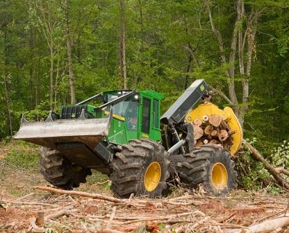
Log skidder dragging logs across a temporary bridgemat
If the banks of the stream are too high for equipment to cross directly, a common approach is to lay slash bundles into the stream bed that can be driven across.  The only downside to this is that they must be removed following operations; this can take some effort and can result in a serious amount of disturbance.  However, this is a much better option than dirt crossings.  Dirt crossings should never be used and are never recommended.  Remember, the point of BMPs is to keep extra dirt from entering the streams, not to add any more.  One of the easiest alternatives for these types of crossings is to use bridgemats, otherwise known as skidder mats or dragline mats.  These mats are constructed of hardwood cants that have been bolted together and are extremely durable and can be used over and over again.  They can be laid in place with the grapples of the skidder and removed in the same fashion once you are done.  The best part is that you have stayed out of the stream bed completely and maximized water quality protection at your temporary stream crossing. 

Once it is time to move off site, temporary stream crossings should be removed and the approaches should be stabilized to reduce erosion.  One way to stabilize approaches is by revegetating them.  On page 65 of the most recent BMP handbook there are guidelines for revegetating disturbed areas, there is even a chart that gives you different seeding options so that you can use the best seed for your site.  Another alternative is to distribute fine slash down the approach (being sure not to put any in the stream bed) and drive over it to ensure firm placement, followed by larger, more coarse slash. 

In conclusion, remember to keep stream crossings to a minimum, always stabilize your approaches and to never use dirt crossings.   Keep the questions coming so we can shed some light on any best management practice confusion that might be out there, you can send your questions to me at tthomas@tfs.tamu.edu or just phone it in by calling (936) 639-8180.

*This article was published in the November 2012 issue of the Texas Logger

Thursday, September 6, 2012

September 2012 BMP Q&A

By: Todd Thomas, Water Resources Forester, Texas A&M Forest Service


Q: Sometimes in order to speed things up, our skidder operator will delimb logs using what is called “backing".  This is where he takes the logs with the skidder grapple and backs them into standing timber, knocking off the limbs before they get to the landing.  Recently I was told that this was not a good practice and that we should not do this anymore.  Are there any BMPs related to this, and why should we not do it?

A: Excellent question, and one that certainly needs to be addressed.  While there are no BMPs that specifically mention “backing", it is something that should not be practiced, especially if it is done in an area where the trees will not be completely harvested, as is the case of a Streamside Management Zone (SMZ).  Backing whole trees in for delimbing can cause excessive damage to the residual stand, making them more susceptible to insects and disease and possibly resulting in mortality.  This completely defeats the purpose of leaving them standing, and if in an SMZ, may not provide the same level of water resource protection. 

In addition to damaging trees, the nature of this process involves equipment intrusion into the SMZ.  If you recall, Texas Forestry BMPs call for equipment traffic to be kept to a minimum within the SMZ, as well as for the “forest floor to be essentially undisturbed".  By backing logs in, these BMP guidelines have not been followed.

Another way in which backing damages SMZ is the potential to create ruts at the edge of the SMZ.  Even if these ruts are small, they can become a direct channel to carry runoff water to the stream and increase erosion.  You can also push back too far, damaging the stream bank itself, and causing it to fail.  While you may have strived to follow BMPs across the entire tract, this simple process can negate the other BMPs by delivering soil directly to the stream. 

Texas Forestry BMPs call for streams to be “clear or debris, such as tops and limbs”.  While you may be pushing the limbs back at the edge of the SMZ, you run the risk of pushing them into the stream.  Even though tops and limbs can fall into the stream bed naturally from storms and dead trees, there is no need to increase this debris from a practice that is not necessary.  As these tips and limbs decompose, they release nutrients that can reduce water quality.  When stream flow increases during rainy weather, limbs and tops are pushed downstream and can dam up the stream, increasing the potential for flooding.  As the limbs are pushed down even further, they can gouge the stream banks, increasing the erosion that occurs naturally within the stream, as well as increasing the amount of soil in the water.

In conclusion, even though skidder operators are well intentioned and are just trying to help out the guys up at the landing, this is a practice that needs to go by the wayside.  It is not worth the damage that can be incurred to the SMZ or the stream, and I wonder about its’ efficiency to the overall operation.  Keep the questions coming so we can shed some light on any best management practice confusion that might be out there, you can send your questions to me at tthomas@tfs.tamu.edu or just phone it in by calling (936) 639-8180.


*This article was published in the September 2012 issue of the Texas Logger

Monday, August 6, 2012

August 2012 BMP Q&A


By: Todd Thomas, BMP Forester, Texas Forest Service

Q: While discussing streamside management zones (SMZs) with a co-worker, the topic of thinning came up.  I told him that the guidelines recommend leaving at least 50 ft2 of basal area per acre.   He insisted that it was 50% crown cover.  Who is right?   Is there really a difference?

 A: Great question.  SMZs provide many critical functions in protecting water quality, so it is important that we don’t limit their effectiveness through over harvesting.  Not only do these areas slow and filter runoff, they also provide shade to streams, maintain bank stability, and lessen the impacts from raindrops that can lead to erosion. 

Now back to your question.  In essence, there is some truth to both answers, though in the event you have a friendly wager riding on this, I would have to side with you.  According to the Texas Forestry Best Management Practices Handbook, within the SMZ of perennial and intermittent streams, a minimum of 50 square feet of basal area per acre should be left.  The residual basal area should be evenly distributed throughout the SMZ in order to provide adequate protection to the stream. 

So what exactly is basal area?  This forestry term is primarily used as a measure of density and is defined as the cross sectional area of a tree stem in square feet at breast height (4.5 feet above the ground).  Since this can sometimes be a difficult concept for people to understand, especially those unfamiliar with forest measurements, the BMP handbook also includes a general rule of thumb that can be used.  Retaining 50% overstory crown cover within the SMZ can usually serve the same purpose, though in order to achieve this, you probably will have to leave a little more than half the trees in a forest that has reached canopy closure. 

Basal area, once you understand it, is very easy to measure, especially when you have the right tool.  A BAF 10 factor prism can quickly help you determine the residual density of the SMZ.  If you don’t have a prism, the BMP handbook includes a section on page 107 that provides information on how to calculate basal area. 

Remember, any time you are working in SMZs, special care is necessary in order to maintain their critical function.  While it is important to manage these areas, operators should continue to follow all related BMPs.  Roads and skid trails should be located outside of these areas when feasible and logging decks should be at least 50 feet from the edge of the SMZ.  Directional felling should also be used to minimize the amount of debris that enters the stream.  Logging slash that inadvertently enters the stream should be removed.  Lastly, minimize the number of bank trees that are harvested, as these help protect the integrity of the stream, provide shade, and stabilize the bank. 

Thanks for taking the time to increase your knowledge of BMPs and keep up the good work out there in the woods.  Also, please send in any BMP questions you may have, because chances are if you are unsure of something, there is someone else out there who has the same question.  Feel free to contact me at tthomas@tfs.tamu.edu or (936)-639-8180. 

*This article was published in the August 2012 issue of the Texas Logger